Quick Directions (if you're in a hurry)

Pomeroy is actually a small town, but south of that, in the hills is a Piece of "heaven" at the Ranger District in the Blue Mountains.
With the first map, just shows the general area in the Pacific Northwest.
It's about a 2 hour drive, south of Spokane. Take 195, south to Colfax, just before town, turn Southwest onto SR127.
About 10 miles to Dusty, turn South onto SR127. Go about 15 miles, over the snake river (Center Ferry).
Near Dodge, at the bottom of the hill there's a "delta" intersection and turn back East towards Pomeroy.
Go about 12 miles into the town of Pomeroy. In town, at the main drag (SR12) and 15th, turn South, which is also SR128.
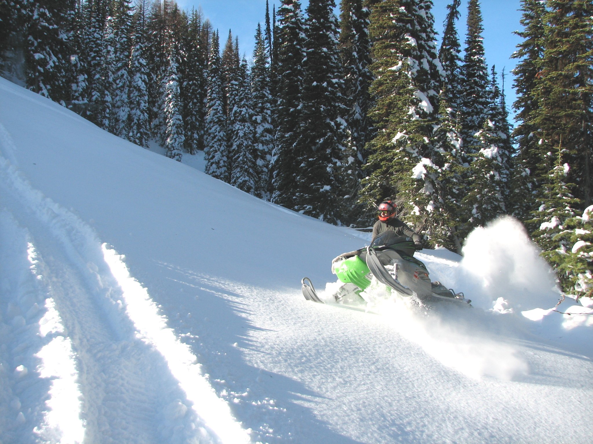
Go about 15 miles and stay on Peola and Mountain Road. About another 5 miles to the parking lot. Permit required. General information for the general public The Blue Mountains are attractive to people year-round, and no less an attraction than in the wintertime, when snowmobiling enthusiasts and cross country skiers head for the hills.
The main access from Pomeroy into the Blue Mountains is State Route 128. Route 128 starts at the intersection of Main and 15th streets in Pomeroy and goes south for 16.5 miles
to the forest boundary, where it becomes Forest Road 40.
There is a parking area at the boundary of the Umatilla National Forest with 25 spaces and it is wide and convenient.
Rose Spring Sno-Park, a short distance further south offers another 30 parking spaces.
The groomed snowmobile trail from Rose Spring to the Misery Junction, which is at an elevation of 6,200 feet, runs south for 16 miles and offers views of the Pataha and Tucannon
drainages.
The mountains have special marked trails for snowmobiling, and back roads offer a challenge as well.
Signs with a snowmobile or other insignia are generally located at the trailhead and show the type of use for which the trail was designed.
Orange trailblazers mark the trail, especially where it is hard to follow, and orange directional markers are used at junctions and at major changes of direction.
Among the trail roads in the mountains, their location and miles marked, are the Mountain Road, 16 miles south of Pomeroy, which has 8.2 miles of trail.
Old Wagon Road, if it has been plowed, is the alternate route.
Iron Springs Road, 17 miles south of town, runs 8.3 marked miles and has telephone lines running parallel to the road. The trail has changing views of the Pataha drainage.
The Clearwater to Mt. Misery marked trail begins 24.2 miles south of Pomeroy and runs for 8.2 marked miles, with steep large drifts from Cougar Spring to Sunset Point.
Use caution on this trail that offers spectacular views of Upper Tucannon River.
The Cloverland Road to Mt. Misery trail begins 34.4 miles south of Pomeroy, runs 6.9 marked miles, with some drifts and side slopes between Wenatchee and Misery.
Enclosed emergency shelters are located at Mt. Misery and Teal campground to aid snowmobilers.
In the event someone is ever lost or injured, the Garfield County Sheriff's Posse can be relied on.
The Pomeroy Ranger District, the northern-most district of the Umatilla National Forest, is located in southeastern Washington and northeastern Oregon.
It includes 365,901 acres at the northeastern edge of the Blue Mountains with 95,467 acres in Garfield County, thus allowing a wide range of recreational opportunities.
The Pomeroy District grooms the Mountain Road #40 for snowmobilers and cross-country skiers. There is ample parking for trailers at Rose Springs and Boundary Sno-Parks.
The groomed trail along the Mountain Road offers an access route into the heart of the District with many opportunities for the users to break off onto side roads or open areas for
snow play.
A snow shelter is available for use by Forest visitors at Misery Junction.
The area includes lands in three Washington counties (Columbia, Garfield, and Asotin) and Wallowa County in Oregon.
These mountains are made up of high plateaus, deeply cut by an intricate system of steep-walled, rim-rock canyons, offering excellent views of the canyons and area surrounding them.
Most of the forest land is in mixed-conifer stands on northern and eastern slopes with Douglas-fir/ponderosa pine on western and southern slopes.
The Pomeroy Ranger District has developed campgrounds, none of which are administered as fee sites.
These include: Tucanonnon Campground, Alder Thicket, Wickiup, Teal, Big Springs, and Godman.
Dispersed campgrounds include: Misery, Spruce Springs, Ladybug, Panjab, Boundary, Pataha and Cabin Saddle.
There are almost 400 miles of managed trails in the Pomeroy District; 263 miles are within the Wenaha-Tucannon Wilderness which prohibits motorized use.
Trails are rated differently for different kinds of use, so be sure to plan ahead and contact the District office for more information concerning the type of
trails that are located in an area you plan to enter.
Since this is in Washington one would assume it's manged by the State Park's Department, however after extensive research, it appears to be managed by the U.S. Forest Service.
For more information about any recreational activity on the Umatilla National Forest call (509)843-1891 or call the 24-hour information line at (509) 843-1339.
Their office is locate at:71 West Main, Pomeroy, WA 99347. Rider's information: The Author performed some research on the "arrangement" for the Parks in this area.
All of the sno-parks; Rose Spring, Colverland, Hatley Gulch and Touchet Corral are State of Washington Parks, however, (in the case of most of) these sno-parks are
normally enforced by U.S. Forest Service people (Fed's).
It's also believed that the State chips in for the grooming, and the ticket's monies mostly go the groomer operations as well.
As of 2005 State Park's citations were $75 while U.S. Forest Service citations are $50.
The State, in some areas has a "2nd chance" policy, whereas, if you don't display a permit and get ticketed, you have three days to produce a permit.
If you do, the citation is most like dropped. It's unknown, at this time, if the U.S.F.S. has something similar.
It might be worth a try contacting the officer at the above phone number.
Also, be careful when parking along the road on the Colverland side. County does not always get the (drifted) road plowed and most riders are forced to park along the road,
being in the County, not on the Park's land, however, are still liable for citation. This was just discovered. It's guessed "their" reasoning is parking along the
county road is not proper use of sno-park whether attempting to avoid buying a permit. But what about those who do have the permit displayed?
This sounds like a jurisdiction and communication mix-up and needs addressing with the locals there.
This information is only to help you be aware of this apparent problem. It's unknown if this happens in other sno-park areas, but is worth calling them to find out.
If you find anything more, have corrections, please contact the Author. East access from the Cloverland sno-park lot A secondary way into the play area is via Cloverland, about a half hour longer. Being a tiny town it's in the south eastern part of the state of Washington, near Clarkston.
It's an early or late season way to go to the same area.This is because, from the Pomero side a few areas on the trails are not covered with snow during these periods.
The directions for the Cloverland side are: from Clarkston, drive south about five miles to Asotin and turn right (west) onto Brumaster road.
About three miles in at the "Y", stay left and up hill in a winding road for another 20 kilometers or so. That's right! This portion of the road is metric!
Park along the road when the snow gets to deep to drive. West access from the Rose Spring sno-park lot (Pomeroy)
During the season the Pomeroy side is a little closer to travel from Spokane. To the Pomeroy side it's about a 2 hour drive, south of Spokane.
Take 195, south to Colfax, just before town, turn Southwest onto SR-127. About 10 miles to Dusty, turn South onto SR-127. Go about 15 miles, over the snake river (Center Ferry).
Near Dodge, at the bottom of the hill there's a "delta" intersection and turn back East towards Pomeroy. Go about 12 miles into the town of Pomeroy.
In town, at the main drag (SR-2) and 15th, turn South, onto SR-128. Go about 15 miles and stay on Peola and Mountain Road.
About another 5 miles is the parking lot at "Rose Spring" sno-park. This is a very trailer friendly lot.
The trails start right here, and some powder fields as well. There's toilet facilities. Unknown about drinking water, however. Permits are strictly enforced. Additional notes from the AuthorWest acceess from the Rose Spring sno-park lot (Pomeroy) The general meeting place is at the grocery store a block south of the hyway around 8th.
This store has plenty of goodies, including pretty good "jo-jo" potatoes for a snack/dinner afterwards. There's enough room to turn a trailer around, too.
There's a couple of places to gas up as well. One is at the far East end of town. Pomeroy Trail Maps: Now these next two maps are very similar, except each one left out it's neighboring sno-park. For example, Eckler is left out on one, while Hatley is left out one the other. 

If these maps do not print correctly on your printer, you are welcome to email or call the Author, Karl, and see what can be done.
Links:


![[Kar's sled page]](images/winter_home3.gif)