Maps
Calispell Peak is the highest mountain in the vicinity of central Pend Oreille county, WA with a summit about 6800 ASL. From Spokane it's about an hour drive. There are several ways to access the area:
From the west, just at the north end of Chewelah, take the road to the air port, onto Cozy Nook Road. At this time the rest of the directions are not availible and will be here, as time permits.
From the North, take SR-20. This will normally be from the Colville area. It's also called the Colville-Tiger Hyway. The mile posts (numbers) increase going East. At mile post 373.8 there's an intersection (side roads). The North side says " Radar Dome ORV...etc. Take the South road, which is Flodelle Creek Road (presumed) and go two tenths of a mile, over the little bridge, to a "Y".
NOTES: From there you can go left, onto Flodelle Creek, to Beaver Lodge. From the right continues to the Cusick direction, eventually turns into (if not already) Tacoma Creek Road. Beaver Lodge way does later meet up to the Tacoma Creek way a few miles down the road. It's mostly sled trails, and only in the summer can other types of vehicles, such as a truck go there. There are also some restriction signs, such as "ORVs" are not allow, which does not include snowmoblies (in the winter).
Continuing on (from two paragraphs, above); From the right turn, go 4.6 miles to a "Y" and stay right. There will be a sign, there that says "Tiger-Colville HWY 5" (you just came from) and "19 Cusick" (you are going). From there go six tenths of a mile to a "Y" and stay right. (Left is Beaver Lodge). From there go a half of mile to a "Y" and stay Left. There's a sign there, with "2389" on it. Presumably, this is a County or F.S. designation. From there, just stay on the main road. Around the "6 1/2" mile area is the unloading area for mid-winter sledding. This trail will take you up to the North end of the mountain's play area. There is one or two intersections on this trail; you'll have to explore a little to which one take you up the mountain. One of the intersections will take to down to the Chewelah side access area. It's about 10 miles down there. At this time detailed trail and road directions are not available. If these directions are confusing or questional, just follow the other and the main travel road, since it's likely there are other people like yourself going riding in this area.
From the East, on SR-20, about a mile or so north of the Shell gas station in the Cusick area, turn West onto Tacoma Creek Road. For reference the US Air Force survival camp is about 3 miles in. If you go another mile or less will be the road to get to the top on the South face. In the summer the road is extremely rough. In the winter is fine, except the last part is an open, steep face not for the faint of heart. This is not to be confused with Calicoma Road, which is only 4.4 miles in from SR-20. If you happen to turn onto Calicoma Road, this will take you back to W. Calispell Road, which loops around (both ways) back to SR-20 as well. Calicoma road has several houses along the way, should there be an emergency.
Back to discussing about the Tacoma Creek road if you skip these unloanding areas, and go in about 9 miles (from SR-20) is a bridge by the creek. This is the most mild way to go, especially if you are bringing in new-comers to the sport. The trail goes around the mountain on the West and and is about 6 miles into the play areas.
The last way is into the Washington State Park's Batey Bould parking lot. This requires a permit. From the Shell station in Cusick, go about 1/4 mile north to a small sign says "Batey Bould", and turn west, onto Kapps Lane. Go about 1/2 mile to a "T" (stop sign) and turn right onto Westside Calispell Road. Go about 1 1/2 mile and turn left (west) onto Trimble Creek Road. Go another 1 or so to the parking lot. It's huge and very trailer friendly.
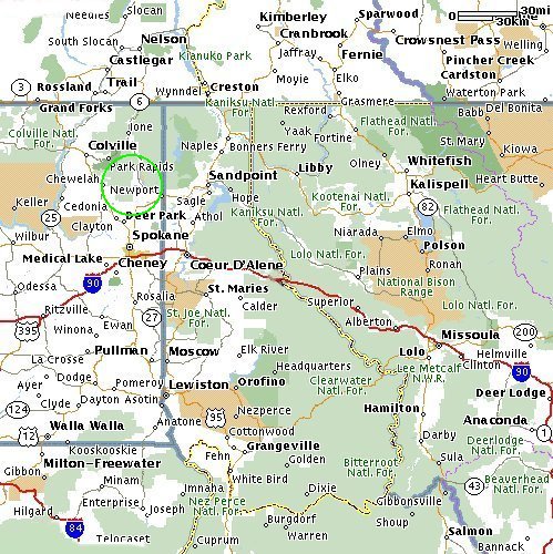
This map zooms in the Cusick/Newport area. It's just off of SR-20.
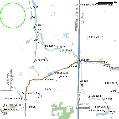
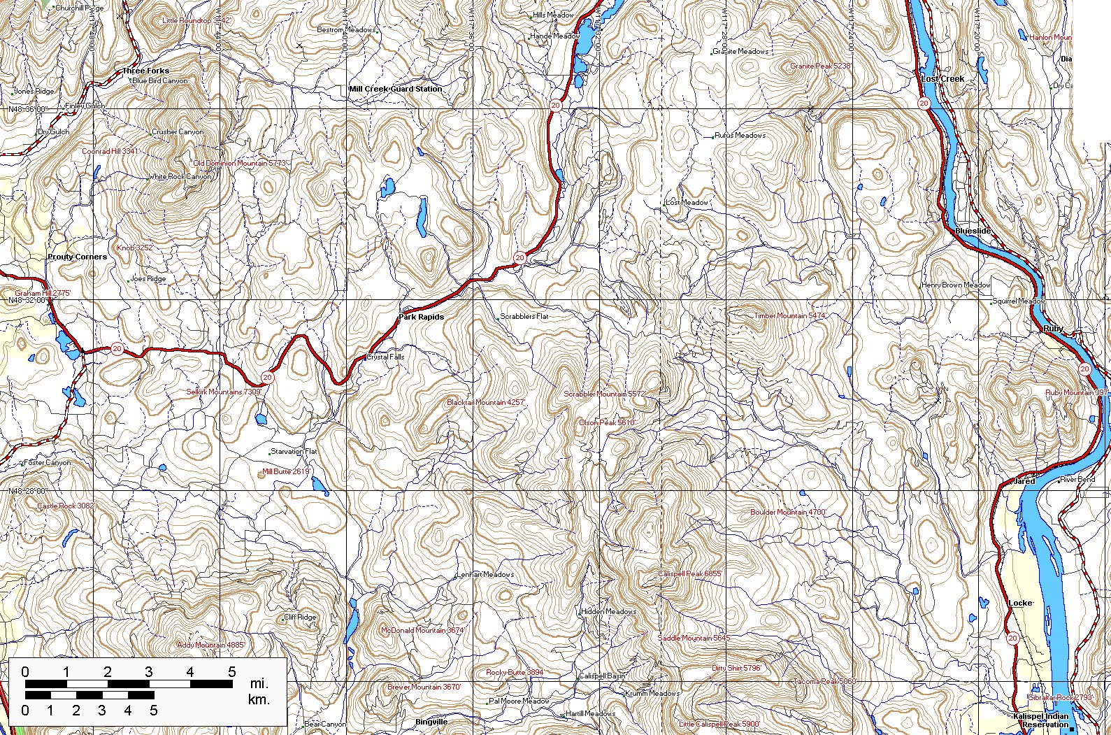
The lower left map shows the way in by road from the hyway 20, just north of Cusick. Both the access road and the two peaks (Calispell and Little Calispell) are marked in light green. (AC, of course). The right picture is the general mountains.Both are enlargeable.


![[Kar's sled page]](images/winter_home3.gif)